It was dark and dreary this
morning with clouds looming overhead, something that we haven’t seen too often
on our journey. We began to pack up the
van as we were going south today. We
were nearly done when Michael and Nikki and the girls came to say goodbye –
they were also leaving this morning. Just
as they did, we felt droplets falling from the sky. OMG, it was rain! Haven’t seen that for a while! It didn’t last long and the shower
disappeared as quickly as it arrived even though the clouds were here to stay a
while. To farewell Coral Bay we pulled
up across the road at the Bakery. We all
chowed down on sweet treats like a wagon wheel, rocky road, jam donut and
custard tart… they were delicious and pretty large servings. The clouds hovered above as we drove out of
town and we did actually get the occasional shower on our drive further
south. We spotted many goats on our
drive as well as the occasional dead cow and a few kangaroos but these were few
compared to the numbers at Cape Range. I
was surprised at how many large areas of dried out animal bones you could see
along this drive and also a little disappointed that there was quite a bit of
rubbish lying around. We eventually
drove in towards Carnarvon, spotting a big satellite dish in the distance on
our way in. We first stopped for fuel
and a snack before hitting the town. We
drove around a little to see if there was anything here that would interest us
and Josh wasn’t sounding too positive about it.
We did end up eventually pulling into the Jetty Train Museum for a squiz
around, finding some old trains, the old lighthouse, the anchor from the Korean
Star which became shipwrecked just north of Carnarvon and a few other old
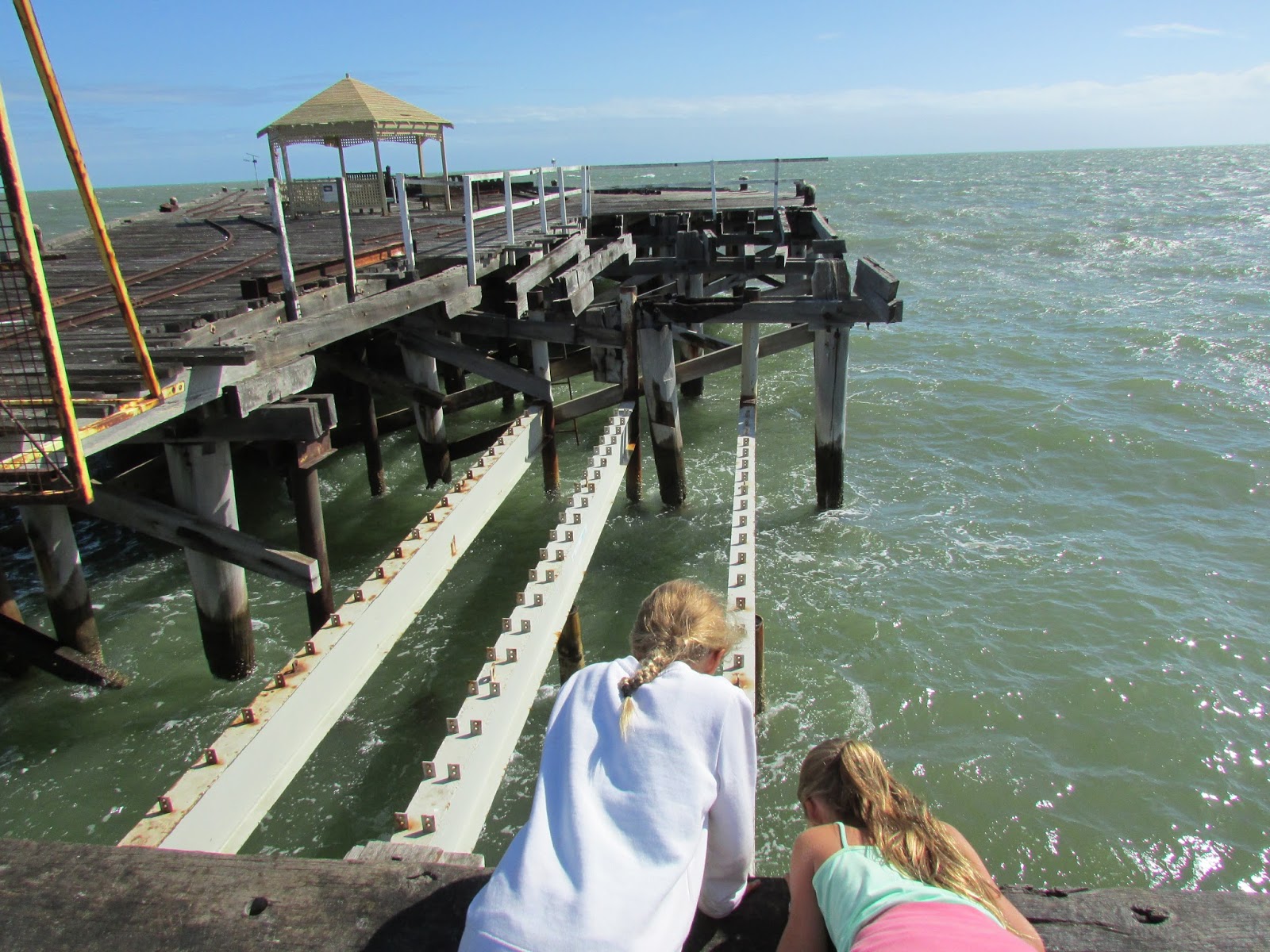
vehicles. Further down the road was One
Mile Jetty which was built in 1897 and used for the export of wool and
livestock such as sheep and cattle. It
was also used to bring in supplies to the town as well as passengers from
Perth. In the 1900’s a tramway was
constructed to transport goods between the town and the jetty, and there is
still a tram (“the Coffee Pot Train”) that runs to the end of the jetty. Josh decided to keep them in business and pay
for a ride on the train rather than walk the jetty so all aboard we got. It was only the four of us on the train so of
course the kids opted for their own carriage – too cool to hang out with their
folks! We rattled along the “not very
straight” rail line all the way to the end and hopped out for a look. It was a shame that fishermen had actually
burned the end of the jetty in their attempt to keep warm so we couldn’t get to
the very tip of it but it was nice all the same. Before reboarding, our train driver Sas
allowed the kids to climb into her cabin and pull the train whistle, which of
course they did more than the once, noisy buggers!! After our train ride, we hopped back in the
car – Josh had decided to head back to the north. We crossed back over the very dry river bed
of the Gascoyne River and out towards Point Quobba, stopping just before the
campground at the Blow Holes. The first
thing that we noticed was the big sign advising that “King Waves Kill” and then
after parking the car, the plaque advising that people had died at this point. Mental note made: be careful and keep a close eye on the kids,
especially as it was very windy which actually made it good viewing of the
blowholes! Point Quobba campground was
pretty full as it was late in the day, but we found a spot in front of a humpie
to at least stay the night. Josh went to
find our camp host but he was nowhere to be found, and as other campers had
pointed out, this was not unusual. So we
set up camp and then went for a walk along the beach. I was impressed with the toilets here, quite
new and very clean – great accommodation at $5.50 per van per night. We settled in for the night in our warm
caravan while the wind whistled outside.
The kids and I had quite a few games of cards before all calling it an
early night.
As it was looking like another
windy day, we packed some food and prepared for a big driving day to see the
coast of this area. We started by
heading back to the Quobba Blowholes and again the wind was blowing which made
for good viewing of the blowholes. We
drove on north to where there was a cairn in memory of the HMAS Sydney which
was torpedoed in November 1941 by the German ship Kormoran. All 645 of the Australian navy crew on board
the HMAS Sydney died and approx. 80 perished from the German ship, the rest
being rescued from the coast near to this cairn. We crossed over the road that the Rio Tinto
Dampier Salt mine uses, and continued north before Josh pulled the car up
again, residing atop the gorgeous red cliffs of the coast with the ocean
belting up against the land below us… it is a very pretty coastline. Our next stop was where the Korean Star sank
– there isn’t much left of it to see but when the waves rush out a little, you
can see a few stacks poking up but that is all that remains from when it was
torn in half back in 1988. Back in the
car, we continued on. Our next stop was
at Red Bluff and the first thing we noticed was another piece of information
about the HMAS Sydney and the Kormoran.
In 2008, money that was fundraised and donated supported the find of both
ships, 66 years after their disappearance, located over 200kms west of Steep
Point, the westernmost point of Australia’s mainland… fascinating! We drove into the Red Bluff which is a
popular surfing spot and a very basic camp – however, they do have a great
little café so we went inside and ordered some drinks. The smoothies here are fantastic!! We got chatting to another couple of tourists
and Sami and I had a quick game of chess before we boarded back in the car… it
was a long driving day today. Our last
stop for the day was about another 20kms of hard red sand and finished in the
station of Gnaraloo, some of you might remember Farmer Paul from Farmer Wants a
Wife? After driving through the stone
gate ends of the station grounds it took us to Three Mile Camp, obviously the
camping grounds for tents, vans, etc.
The little store appeared to be closed so we just drove in and had a
look about including at The Hilton – but not that one – this one was slightly
less fancy! There is no Marble Bar here
(but if you travel over 1000kms north you will come across the town of Marble
Bar). We continued on through the
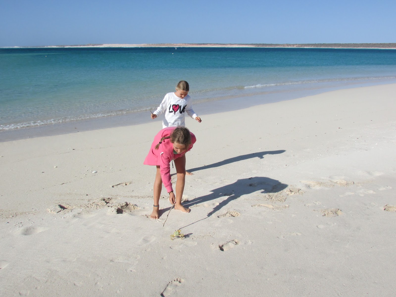
station grounds and past the homestead to Gnaraloo Bay. The kids were poking around on the beach and
Sami found a yellow fiddler crab that escaped its hole and ran (as did timid
little Sami), headed for the sea trying to protect itself. By now it was the middle of the afternoon and
we started our journey back to the van.
Josh did try and take one last detour on our way back, but the track was
covered in rough rocks and was just too time consuming so we turned back out
trying to avoid the many goats. We have
come to the conclusion that goats and sheep are quite smart as they move out of
the road of moving vehicles, unlike kangaroos and cows. The sun was lowering on our way home which
made for a few good photos so we also headed up the lighthouse road for a quick
look. There was nothing there except for
the lighthouse so a quick squiz was all that was in order before heading home
for dinner and a quiet movie.


No comments:
Post a Comment